
Cnocan na Lao [Knocknalee Hill]
Good walks are even better shared.
Overview
Cnocan na Lao [Knocknalee Hill]
Cnocan na Lao, also known as Knocknalee Hill, is a delightful Marilyn that rises to 526 meters in the charming County Longford, Ireland. With a prominence of 75 meters, this hill offers stunning views and a lovely hiking experience.
Geology
The hill is largely underpinned by limestone, pointing to a rich past where ancient seas roamed the land. Its rugged, rocky outcrops provide a fascinating glimpse into the geological forces that shaped this part of Ireland.
Routes
The Knocknalee Hill Loop is the most popular route for hikers, encompassing an enjoyable 5-kilometer loop starting from the village of Lanesborough. This moderate trail blends woodlands with open hilltop, providing ample opportunity for wildlife spotting and beautiful photography. Expect to spend around two hours on this route.
Summit Features
Upon reaching the summit, you're greeted by a sturdy trig point - perfect for that all-important selfie! The modest cairn adds to the traditional charm of completing a hike.
Terrain
The terrain is characterised by lush grass, rocky outcrops, and the occasional boggy patch that might send you back to childhood memories of puddle jumping (yes, those were the good old days!).
Views
The views from the summit are simply spectacular! On a lovely clear day, you'll catch a glimpse of the Shannon River wickering through the landscape, alongside the serene backdrop of the Slieve Blooms. To experience the best views, spring and autumn are your best bets. Just be prepared for the occasional rain shower - it's Ireland after all!
Hazards
Watch out for brisk winds at the summit, especially in winter months, and ensure you're wearing suitable footwear to handle the uneven terrain and the slippery grass.
Nearby Summits
Just a short distance away stands Cnoc na gCon, reaching 490 meters, which can be a great addition to your hiking itinerary.
Access
Getting there is a breeze! The nearest parking is conveniently located in Lanesborough, with a short and pleasant walk leading you to the trailhead. If you prefer public transport, local buses will take you to Lanesborough from Longford and Athlone.
Facilities
After conquering the hill, treat yourself to a meal or a well-deserved pint in one of the local cafes or pubs in Lanesborough. Plus, public toilets are available nearby to refresh yourself before your return journey.
History
The name 'Cnocan na Lao' literally means 'Hill of the Calf'. The backdrop of pastoral life adds to the charm of this picturesque hill, which has been a local landmark for generations. Hikers would do well to remember it is not just a hill; it’s a piece of history that intertwines deeply with local folklore.
So, lace up your walking boots and get ready for a fulfilling day of exploration at Knocknalee Hill! You'll be glad you did.
Explore routes near Cnocan na Lao [Knocknalee Hill]
Public walks starting within 80 km of this hill. Nearby does not mean a route reaches the summit; check its map and access before setting out.
No public routes are currently listed within 80 km of Cnocan na Lao [Knocknalee Hill] on Walkmates. This does not mean there are no paths here. Explore the map and check local access information before planning a walk.
Route planning notes
These notes describe possible approaches, not verified navigable routes or permission to cross land. Check current paths, local access rules and conditions before setting out.
Knocknalee Hill Loop
A scenic loop starting from the village of Lanesborough, offering a delightful combination of woodlands and open hilltop.
Make a day of it, together
Find someone to share the walk with, or organise a day out along a route you like.
Hill facts and local notes
Classifications
Elevation
291m
955 ft
Prominence
128m
Coordinates
53.3759, -9.3253
M118369
OS Map
45
At the Summit
At the summit, hikers will find a modest cairn and an impressive trig point that has been standing tall since the 1950s.
Terrain & Geology
Predominantly composed of limestone, with sedimentary rock formations that hint at ancient marine environments.
Views & Scenery
On a clear day, one can see the majestic Shannon River winding through the landscape, along with distant views of the Slieve Blooms.
History & Heritage
Name Origin
The name 'Cnocan na Lao' translates to 'Hill of the Calf', hinting at a pastoral past.
Historical Significance
The hill is a local landmark for generations of hikers and is steeped in folklore.
Getting There & Facilities
Check current local access restrictions, parking rules and transport timetables before travelling. These notes do not confirm public access to the summit.
Parking
Parking is available in Lanesborough, just a short walk to the trailhead.
Public Transport
Local buses run to Lanesborough from Longford and Athlone, but check schedules as they may vary.
Nearby Facilities
The nearby village of Lanesborough has a few quaint cafes and pubs for refreshments post-hike, as well as public toilets.
Safety Information
Known Hazards
- Strong winds at the summit, especially in winter; uneven terrain with potential for slippery grass.
General Safety Tips
- Check weather conditions before setting out
- Carry appropriate clothing and equipment
- Let someone know your planned route
- Take a map, compass, and GPS device
- Carry emergency supplies: food, water, first aid kit, torch
Hills
Some common questions about the hills answered
Are there group walks up Cnocan na Lao [Knocknalee Hill]?
Many walkers use Walkmates to join or organise walks with others. You can check for group walks around Cnocan na Lao [Knocknalee Hill] through the maps
Are there other walkers around Cnocan na Lao [Knocknalee Hill]?
Activity varies by location and time, but Walkmates lets you see whether others have shared walks or shown interest in this area. Find other people through the walking friends search walking friends for Cnocan na Lao [Knocknalee Hill] search or of course create your own walk for Cnocan na Lao [Knocknalee Hill]
Can I organise a walk to Cnocan na Lao [Knocknalee Hill]?
Yes. If there aren’t any walks listed already, you can create a walk and make it available for others to join.
If you're signed up to Walkmates, you can create a walk to Cnocan na Lao [Knocknalee Hill].
How do I find a walk up this hill?
There are often multiple ways to walk this hill, depending on experience and route preference. Walkmates helps you explore walks and routes that others have shared.
Can I suggest a new route up Cnocan na Lao [Knocknalee Hill]?
Yes. You can suggest or create routes to share with others. Walkmates focuses on the social side of walking, so routes are used to help people organise walks and explore areas together, rather than as detailed navigation tools or route libraries.
Other uses really appreciate knowledgeable walkers sharing their routes. Share your favourite route to Cnocan na Lao [Knocknalee Hill] here
The is an error or something incorrect about this hill. How do I let you know?
We always strive to keep the information on Walkmates as accurate as possible. If you find an error, please let us know through the contact form and we'll aim to correct it as quickly as possible
Community Discussion
Comments
Location
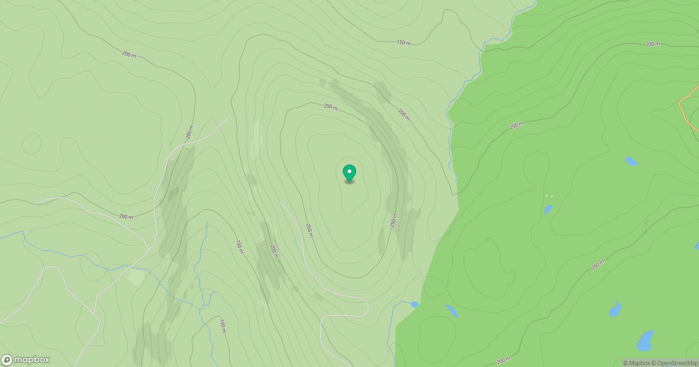
Grid reference: M118369
View on OpenStreetMapOpens a map in a new tab, centred on the hill.
Hills within 30 km
Straight-line distance, not a walking route or confirmation of access.
Leam Hill [An Leim]
253m
Keeraunnageeragh [Derroura] [Caoran na gCaorach]
305m
Benlevy [Mount Gable]
418m
Lackavrea
396m
Cnoc an Mhama [Knocknagussy]
454m
No comments yet. Be the first.